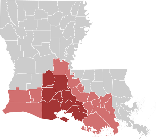
Map of Louisiana with Acadiana highlighted, and Cajun Heartland, USA in dark red
Acadiana (/əˌkeɪdiˈænə/; French and Louisiana French: L’Acadiane or Acadiane), also known as Cajun Country (Louisiana French: Pays des Cadiens), is the official name given to the French Louisiana region that has historically contained much of the state’s Francophone population.[1]
Many inhabitants of Cajun Country have Acadian ancestry and identify as Cajuns or Creoles.[2] Of the 64 parishes that make up the U.S. state of Louisiana, 22 named parishes and other parishes of similar cultural environment make up this intrastate region.[3][4] Lafayette Parish and the seven surrounding parishes are identified as the “Cajun Heartland, USA” district.[5]
Etymology
The word “Acadiana” reputedly has two origins. Its first recorded appearance dates to the October 15, 1946, when a Crowley, Louisiana, newspaper, the Crowley Daily Signal, coined the term in reference to the area of Louisiana in which French descendants of the Acadians settled.[6] However, KATC television in Lafayette independently coined “Acadiana” in the early 1960s, giving it a new, broader meaning, and popularized it throughout southern Louisiana. Founded in 1962, KATC was owned by the Acadian Television Corporation. In early 1963, the ABC affiliate received an invoice erroneously addressed to the “Acadiana” Television Corp. Someone had typed an extra “a” at the end of the word “Acadian”. The station started using it to describe the region covered by its broadcast signal.[7]
Today, numerous business, governmental, and nonprofit organizations incorporate Acadiana in their names, e.g., Mall of Acadiana and Acadiana High School. Notably, KLFY-TV, the regional CBS affiliate, used the term in its “Hello News” branding campaign as “Hello Acadiana”. KATC hosts a morning television show, “Good Morning Acadiana”.[8]
History
Historically part of French Louisiana, present-day Acadiana was inhabited by Attakapa Native Americans at the time of European encounter.[9] After the expulsion of French-speaking Acadian refugees from Canada by the victorious British at the end of the Seven Years’ War, many Acadians settled in this region.[10][11] Most Acadians can trace their ancestry to approximately 50 families who lived in Port Royal, Acadia, now Annapolis Royal, Nova Scotia. The Acadians intermarried with other settlers, forming what became known as Cajun culture.[12]
In 1971, the Louisiana State Legislature officially recognized 22 Louisiana parishes and “other parishes of similar cultural environment” for their “strong French Acadian cultural aspects”.[13] It made “The Heart of Acadiana” the official name of the region, although the term Acadiana is the more common name for the region.[14] The official term appears on regional maps and highway markers.
“Cajun-Creole” redirects here. For Alabama’s Cajun Country, see Cajan Country.
In 1810, the initial reported spread of settlement in Alabama was along the lower Tombigbee and Mobile rivers, consisting of 500 whites and 250 black people, 59 of whom were free.[7][8] Mixed-race descendants of these settlers intermarried and rapidly increased in quantity of households over the generations, according to census records, which typically labelled them as Black, mulatto, or free colored persons.[9] The surname Chastang is shared among the Cajans and the Alabama Creoles.[1] One of the progenitors of the Alabama Creole Chastangs was Jean Chastang, a Frenchman who settled outside Mobile.[10]
Like Alabama Creoles, the Cajans were also unrelated to the Louisiana Cajuns, who are of Acadian descent.[11][12] They were noted to be starkly different from Alabama Creoles, and Cajuns, given that they were mostly Protestant and had English names.[13] They received the name “Cajan” from the Alabama State senator, L.W. Mcrae.[14] Being sensitive to the term “Cajan”, they were observed to prefer referring to themselves simply as “Our people”, a name also used by the Chestnut Ridge people.[15][16]
The Alabama Cajans were an ethnic group of free Black, white, Creole, and possible Native American ancestry in colonial Alabama.[1][4][7][8] They resided mostly in the counties of Mobile, Washington, and Clarke. They socially assorted apart from local whites and Black people, as a population isolate in the racial hierarchy of Alabama. “Cajan” was an exonym which members of these communities often considered pejorative.[9] They instead referred to themselves as “Our People”.[1]
The Cajans were given their label by a local politician, but were unrelated to the Louisiana Cajuns. The MOWA Band of Choctaw Indians consists of a portion of their descendants, while others integrated into white communities, both local and distant.[1][4][10][9]
See also: Alabama Cajans
Exploring Cajun Country on a Southern Louisiana Road Trip
Top Ways to Experience Cajun Culture in Louisiana
Want to experience everything Cajun? Try these top Cajun things to do in Louisiana.
By ExploreLouisiana.com Editorial Team
At a Glance
- Cajun culture originates from French-speaking Acadians exiled from Canada who settled in southern Louisiana. Centered in Acadiana (Lafayette and surrounding areas), it blends French, Spanish, African and Native American influences.
- Cajun culture is known for iconic dishes like gumbo, jambalaya and boudin, fiddle-driven zydeco rhythms and bayou living.
- Cajun experiences include visiting Cajun restaurants, swamp tours, fishing, attending a Cajun cultural festival and live music halls.
Few places in the country offer a culture as distinct and deeply lived as Louisiana’s Cajun Country. Since their exile from Canada in 1755, the Acadians have created their own cuisine and musical styles, and even a dialect known as Cajun French. Acadiana even has its own capital (Lafayette), complete with a flag honoring its Spanish, French and Catholic roots. So get ready, because once you’ve tried a bite of crawfish pie or boudin, you’ll want to thank a Cajun.
Kick Up Your Heels at a Fais do-do
You know it when you hear it: Cajun music is the lively, irresistibly danceable counterpart to the region’s spicy cuisine. The upbeat sounds of fiddles, accordions and acoustic guitars ring throughout the dance halls and restaurants of South Louisiana. Even if you spend just a little time down here, you’re almost guaranteed to find a party known as the fais do-do (pronounced fay doe doe). Head to Fred’s Lounge in Mamou for authentic Cajun music, or to the Blue Moon Saloon in Lafayette for live music and great dancing.
The World Championship Gumbo Cookoff in New Iberia doubles as one of the state’s largest fais do-dos.
Lagniappe (something extra): Start learning how to speak Cajun French.
Cajun Food: Eat What the Locals Eat
Cajun cooking is known around the world for its unmistakable spice and uncommon flavors. Gumbo, jambalaya, boudin — there are more dishes to try here than you can fit into one trip. Taste outstanding Cajun dishes in such restaurants as Rita Mae’s Kitchen in Morgan City, A-Bear’s Café in Houma and Steamboat Bill’s in Lake Charles.
Cajun restaurants in Louisiana so good locals want to keep them secret
Is the diet healthy in cajun country cuisine Search Videos
Lagniappe: Learn the difference between Cajun and Creole food.
Learn About Cajun Traditions
The Cajuns’ exile from Nova Scotia in 1755 is a story more worthy of a Hollywood film than just history books. Today, you can learn about the Acadians at the Acadian Museum in Erath and the Acadian Memorial in St. Martinville.
Lagniappe: Explore six more ways to learn about Cajun history in Louisiana.
Visit Lafayette
Louisiana’s fourth-largest city is also the capital of Acadiana. Set smack in the middle of Cajun Country, Lafayette is a town well known for its restaurants — the city is said to have more per capita than anywhere else in the nation. The claim is bolstered by AAA Southern Traveler, which once named Lafayette the “tastiest town in the South.”
Lagniappe: Get our Lafayette day-trip itinerary.
Travel the Backroads & Bayous
There are great driving tours around this part of the state. The Creole Nature Trail All-American Road is a 180-mile remote highway spanning southwest Louisiana, and visitors to its website can download free maps and audio tours. The America’s Wetland Birding Trail is a driving tour that takes visitors to sites across 22 southern Louisiana parishes, where visitors can see birds on their way to nesting grounds in South America (or on their way back).
Lagniappe: Discover more trails and byways in Louisiana.
Cast a Line
Ready to go fishing? Cast a line and reel in your own Cajun-style dinner. Local fishing charters in Chauvin and Houma will set you up with an offshore or inland fishing trip you’ll be bragging about to friends long after you’ve stepped ashore. If you prefer to go solo, you’ll find fine fishing spots at Vermilion Bay and Grand Isle State Park.
Lagniappe: Find the best kayak, shore and pier fishing spots in Grand Isle.
Respect the Swamp Monsters
Alligators are known as the “king of the swamps” for good reason — some of these bad boys measure up to 13 feet long, weighing in at over 500 pounds. One of the best ways to see gators and other creatures of the bayous is by getting off dry land and onto the water. Airboat tours offer an adrenaline rush like no other, while houseboat rentals and swamp tours in the Atchafalaya Basin will get travelers into some of Louisiana’s most remote reaches.
Lagniappe: Get our definitive swamp tour packing list.
Sip the Local Spirits
There’s a small-batch liquor renaissance going on in Louisiana, and much of it is taking place in Cajun Country. Louisiana Spirits in Lacassine began producing Bayou Rum in 2011. Three childhood friends vowed to utilize one of Louisiana’s oldest crops, sugar cane, to create the best Louisiana rum (Louisiana’s oldest liquor) for the world to enjoy. Stop by for a visit, take a distillery tour and taste for yourself.
Lagniappe: Taste your way across the state on the Louisiana Libations Trail.
Do Mardi Gras Cajun-Style
There are two sides to Mardi Gras. There’s the kind you know — floats, beads, parades — and another kind, lesser known to those outside Louisiana. Cajun Mardi Gras is a tradition you’ll find in Church Point, Mamou and Eunice, wherein masked men team up on horseback early on Mardi Gras day and ride through town searching (ceremonially) for ingredients to use in a big pot of communal gumbo.
Lagniappe: Here’s how to experience Cajun Mardi Gras in Louisiana.
Take a Piece of Acadiana Home With You
Collecting Cajun souvenirs is a great way to celebrate an unforgettable trip. Take a tour of the TABASCO Factory in Avery Island and stock up on your hot sauce supplies. Find albums by popular artists like Leon Thomas and Sabrina Carpenter, plus local bands and Cajun musicians, at Lagniappe Records in Lafayette. Or take home a one-of-a-kind piece of Louisiana art from A & E Gallery/Paul Schexnayder in New Iberia.
Lagniappe: Explore our favorite ways to shop local in Louisiana.
Frequently Asked Questions About Cajun Culture
What is Cajun culture in Louisiana?
Cajun culture refers to the traditions, food, music and lifestyle of the descendants of French-speaking Acadians who settled in southern Louisiana after their exile in 1755. Today, it’s known for its strong sense of community, unique dialect (Cajun French) and rich cultural expressions like music, dance and cuisine.
Where is Cajun Country in Louisiana?
Cajun Country—also called Acadiana—is located in southern Louisiana, with cities like Lafayette serving as cultural hubs. The region is known for its bayous, small towns and deep-rooted traditions.
What are the most popular Cajun foods to try?
Some of the most iconic Cajun dishes include gumbo, jambalaya, boudin and crawfish étouffée. These meals often feature local seafood, rice and the “Holy Trinity” of onions, bell peppers, and celery.
What is Cajun music and where can you hear it?
Cajun music is a lively genre featuring instruments like the accordion and fiddle, often sung in French and tied to dancing traditions. You can experience it at dance halls, festivals and events known as “fais do-do.”
What are the best ways to experience Cajun culture?
Visitors can experience Cajun culture by attending live music events, trying authentic local cuisine, exploring museums, driving scenic bayou routes and participating in festivals or dance gatherings.
Beating Cancer in Cajun Country: A Personal Story of Challenge & Triumph in Opelousas
Cancer Rates in Cajun Country (Louisiana)
Cajun Country refers to the French-speaking, rural, and often agricultural regions of Louisiana, particularly in the Acadiana area. While “Cajun” is a cultural identity, cancer rates in this region are best understood through Louisiana’s cancer incidence data and environmental health factors.
Overall cancer rates in Louisiana
Louisiana’s age-adjusted cancer incidence rate (all cancers combined) is 489.2 per 100,000 people, compared to the U.S. average of 448.6 per 100,000 State Cancer Profiles. This means Louisiana residents are diagnosed with cancer at a higher rate than the national average.
Site-specific rates (all stages, 2018–2022) State Cancer Profiles:
- Lung & Bronchus: 60.9 (U.S. 52.5) — higher than national average.
- Prostate (Male): 147.2 (U.S. 116.4) — significantly elevated.
- Breast (Female): 131.5 (U.S. 131.3) — very close to national average.
- Bladder: 18.1 (U.S. 18.8) — slightly higher.
- Kidney & Renal Pelvis: 23.8 (U.S. 17.5) — higher.
- Liver & Bile Duct: 10.7 (U.S. 8.6) — higher.
- Non-Hodgkin Lymphoma: 18.7 (U.S. 18.5) — similar.
- Melanoma of the Skin: 18.7 (U.S. 23.1) — lower than national average.
Environmental factors
The Acadiana region overlaps with “Cancer Alley”, an 85-mile stretch of the Mississippi River between New Orleans and Baton Rouge with over 200 petrochemical plants Johns Hopkins Bloomberg School of Public Health. Studies show this area has the highest risk of cancer from industrial air pollution in the U.S., more than seven times the national average Johns Hopkins Bloomberg School of Public Health. Pollutants from these facilities are linked to increased risks of maternal, reproductive, respiratory, and certain cancers.
Implications for Cajun Country
- Rural Louisiana communities, including Cajun areas, may face higher cancer risks due to both geographic cancer incidence patterns and proximity to industrial pollution.
- Environmental exposures in “Cancer Alley” could contribute to elevated rates for certain cancers, especially lung, bladder, and kidney cancers.
- Screening and prevention efforts are critical, as early detection can improve outcomes.
Summary
Cancer rates in Cajun Country are generally higher than the U.S. average, particularly for lung, prostate, bladder, and kidney cancers. Environmental pollution from nearby industrial facilities may be a contributing factor, especially in areas within “Cancer Alley.” Public health strategies should address both screening access and environmental health risks to reduce disparities. Louisiana Cancer Data Visualization
Cancer rates in Cajun Country—particularly the industrial corridor known as Cancer Alley—are significantly higher than state and national averages, with multiple sources documenting elevated cancer risks linked to petrochemical pollution. The region, an 85‑mile stretch along the Mississippi River between Baton Rouge and New Orleans, contains one of the highest concentrations of petrochemical plants in the United States and shows some of the most alarming cancer statistics in the country.
🎯 Key Takeaways
- Cancer Alley communities face cancer risks up to seven times the U.S. average, with some estimates showing up to 47× the EPA’s acceptable risk level.
- Predominantly Black and low‑income parishes—including St. John the Baptist, St. James, Iberville, and Ascension—bear the highest burden.
- Airborne industrial pollutants, especially chloroprene and other petrochemical byproducts, are the primary drivers of elevated cancer risk.
- Louisiana’s statewide cancer incidence rate (2018–2022) is 489.2 per 100,000, well above the U.S. rate of 448.6 per 100,000.
🧭 What Counts as “Cajun Country”?
Cajun Country overlaps heavily with the parishes of Ascension, Iberville, St. James, St. John the Baptist, St. Charles, Jefferson, and parts of East/West Baton Rouge—all within Cancer Alley. These areas combine:
- High petrochemical density
- Historic Black and Cajun/Creole communities
- Longstanding environmental justice concerns
🧪 What the Data Shows
1. Extreme Cancer Risk Hotspots
- One area in Cancer Alley has the highest industrial‑air‑pollution cancer risk in the United States, more than 7× the national average.
- Chloroprene levels in St. John the Baptist Parish (near the Denka plant) are among the most dangerous in the country.


2. Statewide Cancer Incidence (Louisiana vs. U.S.)
From the State Cancer Profiles dataset (2018–2022):
- All cancer sites: Louisiana 489.2 vs. U.S. 448.6
- Colon & rectum: 44.3 vs. 36.7
- Lung & bronchus: 60.9 vs. 52.5
- Prostate (male): 147.2 vs. 116.4
These elevated statewide numbers are heavily influenced by the industrial corridor parishes.
3. Environmental Justice Findings
- Cancer Alley’s industrial facilities are disproportionately located in historically Black communities, often on former plantation land.
- Cancer incidence rates in some zones are “alarmingly above national standards.”
🗺️ Localized Cancer Data for Cajun Country
The Louisiana Tumor Registry provides parish‑ and census‑tract‑level cancer incidence data, including:
- Annual cancer incidence maps (2018–2026)
- Cancer zone maps
- Environmental risk dashboards
These tools confirm that the highest cancer incidence clusters align with the petrochemical corridor.
🧩 Why Cancer Rates Are So High
- Petrochemical emissions (benzene, chloroprene, ethylene oxide, formaldehyde)
- Legacy pollution in soil and groundwater
- Socioeconomic vulnerability (limited healthcare access, historic segregation)
- Regulatory gaps and underestimation of industrial emissions
🧭 If you want to explore further
You can dive deeper into:
- Cancer Alley health impacts
- Louisiana Tumor Registry data
- Environmental justice in Cajun Country
If you want, I can also break down cancer rates by specific parish, compare Cajun Country to the rest of Louisiana, or explain which pollutants are most strongly linked to cancer risk.
Cajun Country’s cancer rates are generally higher than the Louisiana state average, but the picture is complex because different datasets show different patterns depending on which parishes are included. The most authoritative statewide dataset—the State Cancer Profiles parish‑level incidence table—shows that many Cajun Country parishes exceed the Louisiana average of 489.2 cases per 100,000.
Below is a clear, data‑driven comparison using the most recent available numbers (2018–2022).
📊 How Cajun Country Compares to the Rest of Louisiana
🗺️ What counts as “Cajun Country” for cancer‑rate analysis?
For epidemiological purposes, Cajun Country typically includes parishes such as:
- Iberville, Ascension, St. James, St. John the Baptist, Iberia, St. Martin, Vermilion, Acadia, St. Landry, Assumption, Avoyelles, Evangeline, West Baton Rouge
These overlap heavily with the Mississippi River industrial corridor (often called Cancer Alley), though not all Cajun parishes are in the corridor.
📈 Parish‑Level Cancer Rates (Cajun Country vs. Louisiana Average)
The Louisiana statewide cancer incidence rate is: 489.2 per 100,000 (2018–2022).
Below are selected Cajun Country parishes and how they compare:
| Parish (Cajun Country) | Rate per 100k | Above/Below LA Avg? |
|---|---|---|
| Iberville | 596.5 | ⬆️ Much higher |
| Vermilion | 546.7 | ⬆️ Higher |
| Iberia | 530.5 | ⬆️ Higher |
| St. Martin | 528.4 | ⬆️ Higher |
| Acadia | 537.4 | ⬆️ Higher |
| St. Landry | 538.2 | ⬆️ Higher |
| Assumption | 515.2 | ⬆️ Higher |
| St. James | 511.2 | ⬆️ Higher |
| West Baton Rouge | 511.1 | ⬆️ Higher |
| Evangeline | 521.2 | ⬆️ Higher |
| Avoyelles | 511.3 | ⬆️ Higher |
Conclusion: Most Cajun Country parishes have cancer incidence rates 20–100 points higher than the Louisiana average. Iberville Parish stands out with one of the highest rates in the entire state.
🆚 Cajun Country vs. the Rest of Louisiana
Overall pattern
- Cajun Country: Frequently higher-than-average cancer incidence, especially in parishes overlapping industrial zones.
- Rest of Louisiana: More mixed, with many rural northern parishes showing lower or mid‑range incidence.
Why the difference?
Based on environmental health research:
- The Mississippi River industrial corridor has the highest industrial‑air‑pollution cancer risk in the U.S., more than 7× the national average.
- These elevated risks align geographically with several Cajun Country parishes.
⚠️ Conflicting narrative from industry groups
The Louisiana Chemical Association claims the industrial corridor has lower cancer incidence (468.6 per 100k) than the rest of the state (495.7). However, this contradicts the official State Cancer Profiles parish‑level data, which shows many corridor/Cajun parishes well above the state average.
🧭 What this means
- Most Cajun Country parishes have higher cancer rates than Louisiana overall, according to federal cancer registry data.
- Environmental exposure—especially in parishes like Iberville, St. James, and St. John the Baptist—appears to be a major factor.
- Industry‑funded analyses present a different picture, but they conflict with independent and federal datasets.
Want deeper detail?
I can break down:
- Cajun Country cancer rates by specific cancer type
- Cancer Alley vs. Cajun Country differences
- Environmental risk factors in high‑incidence parishes
Would you like a map‑based breakdown, a parish‑by‑parish table, or a pollutant‑specific analysis next?
You’re asking the right questions—this is where the story really sharpens: what kinds of cancer, where exactly, and why there. Let’s break it cleanly into the three pieces you named.
Cajun Country cancer rates by specific cancer type
I’ll speak in patterns rather than exact numbers, since rates shift year to year, but the trends are consistent across recent data.
1. Lung and bronchus cancer
- Pattern: Lung cancer rates in Cajun Country are higher than the U.S. average and often similar to or higher than the Louisiana average.
- Why:
- Smoking prevalence is historically high in Louisiana.
- Industrial air pollution (fine particulates, volatile organic compounds, and specific carcinogens like benzene) adds an additional burden in some parishes.
- Where it’s worst: Parishes overlapping the industrial corridor—like Iberville, St. James, St. John the Baptist, Ascension—tend to show elevated lung cancer incidence and mortality.
2. Colorectal (colon and rectum) cancer
- Pattern: Louisiana as a whole has elevated colorectal cancer rates compared with the U.S., and many Cajun Country parishes track at or above the state average.
- Drivers:
- Lower screening rates (colonoscopy, stool tests) in some rural and low‑income communities.
- Diet, obesity, and limited access to preventive care.
- Takeaway: Colorectal cancer is a major contributor to the overall high cancer burden in Cajun Country, not just an industrial story.
3. Breast cancer (female)
- Pattern: Breast cancer incidence in Cajun Country is often similar to the state average, but mortality can be higher in lower‑income and predominantly Black communities.
- Why:
- Later stage at diagnosis (screening and follow‑up barriers).
- Treatment access—distance to oncology centers, insurance gaps, transportation.
- Important nuance: The rate may not look extreme, but outcomes (survival, stage at diagnosis) can be worse.
4. Prostate cancer (male)
- Pattern: Louisiana has high prostate cancer incidence, and Cajun Country—especially parishes with large Black populations—often shows elevated rates and mortality.
- Drivers:
- Genetic and biological factors in Black men.
- Access to screening and early treatment.
- Overlay with environment: While prostate cancer is less directly tied to specific pollutants than, say, lung cancer, the same communities facing environmental risk are often those with weaker healthcare access.
5. Other cancers with environmental links
- Leukemia and lymphomas: Sometimes elevated in areas with long‑term exposure to benzene and other solvents.
- Liver cancer: Influenced by hepatitis, alcohol, obesity, and possibly some chemical exposures.
- Kidney and bladder cancers: Can be associated with certain industrial chemicals and contaminated water, though the signal is often mixed with lifestyle factors (like smoking).
Cancer Alley vs. Cajun Country differences
Think of it this way: Cajun Country is a cultural/region concept; Cancer Alley is an industrial corridor concept. They overlap, but they’re not identical.
1. Geography and definition
- Cajun Country:
- Broad region of south Louisiana (e.g., Acadia, Vermilion, St. Landry, Iberia, St. Martin, Assumption, Avoyelles, Evangeline, plus parts of the river parishes).
- Defined by culture, language, and history more than industry alone.
- Cancer Alley:
- Roughly the 85‑mile Mississippi River corridor between Baton Rouge and New Orleans.
- Includes parishes like Iberville, Ascension, St. James, St. John the Baptist, St. Charles, parts of East/West Baton Rouge, Jefferson.
- Defined by high density of petrochemical and industrial facilities.
2. Cancer burden comparison
- Cancer Alley (industrial corridor):
- Tends to have some of the highest cancer risks from air toxics in the U.S.
- Certain census tracts show extreme modeled cancer risk from specific pollutants (e.g., chloroprene, ethylene oxide).
- Some parishes in this corridor also have very high overall cancer incidence.
- Broader Cajun Country:
- Includes rural, less industrial parishes where cancer rates are still high but may be driven more by poverty, healthcare access, lifestyle factors, and chronic disease than by heavy industry alone.
- So: not all of Cajun Country is Cancer Alley, but many of the worst‑off parishes sit where the two overlap.
3. Who is most affected?
- Cancer Alley:
- Disproportionately Black communities, often living near plants, rail yards, and tank farms.
- Environmental justice is central: communities with the least power bear the highest exposure.
- Cajun Country overall:
- Mix of Cajun, Creole, Black, and other communities, with shared burdens of poverty, limited healthcare, and sometimes environmental risk.
- The cultural region is broader than the industrial corridor, so the story includes both industrial and non‑industrial drivers of cancer.
Environmental risk factors in high‑incidence parishes
In the parishes where cancer rates and/or modeled cancer risk are highest, several environmental and social factors stack on top of each other.
1. Petrochemical and industrial emissions
- Key pollutants:
- Chloroprene (e.g., from neoprene production)
- Ethylene oxide (sterilization, chemical manufacturing)
- Benzene, 1,3‑butadiene, formaldehyde, and other VOCs
- Fine particulate matter (PM2.5) from combustion and industrial processes
- Health relevance:
- Many of these are known or probable human carcinogens.
- Long‑term exposure is linked to leukemia, lymphomas, lung cancer, and other malignancies.
2. Legacy pollution and land use
- Old waste pits, unlined landfills, and contaminated soil/groundwater near former or current industrial sites.
- Communities sometimes live on or near former plantation land that later became industrial zones, creating a historical chain: slavery → sharecropping → industrial siting → environmental exposure.
3. Air quality and proximity
- Many high‑incidence communities are:
- Within a few miles—or even a few hundred yards—of major plants, flares, and storage tanks.
- Downwind of clusters of facilities, not just a single plant.
- This means cumulative exposure: multiple pollutants from multiple sources over decades.
4. Water and infrastructure
- Aging water systems and potential contamination from industrial runoff or historical dumping can add to risk, though the evidence is often more mixed and localized than for air.
- Flooding and hurricanes can redistribute contaminants, stirring up old pollution.
5. Social and healthcare factors (the “force multipliers”)
Even if two places have similar pollution, the one with weaker social infrastructure will usually see worse health outcomes.
- Poverty and underinsurance:
- Delayed diagnosis, fewer preventive visits, less consistent treatment.
- Limited access to specialists:
- Long travel distances to oncologists or major hospitals.
- Lower screening rates:
- Fewer mammograms, colonoscopies, Pap tests, and lung cancer screening (low‑dose CT) in high‑risk smokers.
- Chronic stress and racism:
- Environmental racism and economic marginalization can contribute to chronic stress, which interacts with physical health and healthcare use.
Putting it together
- Cajun Country has high overall cancer rates, driven by a mix of industrial exposure, lifestyle factors, and healthcare access issues.
- Cancer Alley is the sharpest edge of that story—where industrial pollution and environmental racism are most concentrated.
- By cancer type, lung, colorectal, prostate, and some hematologic cancers (like leukemias) are especially important in understanding the burden.
If you’d like to go even deeper, I can:
- Walk through a hypothetical parish (say, Iberville or St. James) and trace how industry, demographics, and healthcare access intersect.
- Or focus on one cancer type (like lung or colorectal) and map out what prevention and policy changes would realistically move the needle there.
Cancer Alley and Cajun Country overlap on a map, but they are not the same thing. One is a cultural region; the other is an industrial corridor with some of the highest pollution‑linked cancer risks in the United States. Understanding the difference makes the health story in south Louisiana much clearer.
🌍 What Cancer Alley Is
Cancer Alley is an 85‑mile industrial corridor along the Mississippi River between Baton Rouge and New Orleans. It contains more than 150 petrochemical plants and refineries, making it one of the most heavily industrialized regions in the country.
Defining traits
- Industrial identity: petrochemical complexes, refineries, plastics plants
- Environmental justice hotspot: predominantly Black communities near industrial sites
- High modeled cancer risk: some census tracts show 7× the U.S. average
- Pollutants of concern: chloroprene, ethylene oxide, benzene, 1,3‑butadiene, formaldehyde
Key parishes
- St. John the Baptist
- St. James
- Iberville
- Ascension
- St. Charles
- East/West Baton Rouge
- Jefferson
These parishes anchor the national conversation about pollution‑linked cancer risk.
🎺 What Cajun Country Is
Cajun Country—often called Acadiana—is a cultural region, not an industrial one. It’s defined by French heritage, foodways, music, and rural communities.
Defining traits
- Cultural identity: Cajun and Creole heritage
- Rural and agricultural: rice, sugarcane, crawfish, cattle
- Mixed health drivers: poverty, limited healthcare access, chronic disease
- Not inherently industrial: though some parishes overlap with Cancer Alley
Key parishes
- Acadia
- Vermilion
- Iberia
- St. Martin
- St. Landry
- Evangeline
- Avoyelles
- Assumption
- St. Mary
Some of these parishes have high cancer rates, but for different reasons than the industrial corridor.
🔍 Cancer Alley vs. Cajun Country: The Core Differences
1. Purpose of the region
- Cancer Alley → defined by industry and pollution
- Cajun Country → defined by culture and history
2. Cancer risk drivers
- Cancer Alley → industrial emissions (chloroprene, ethylene oxide, benzene)
- Cajun Country → healthcare access, poverty, lifestyle factors, and in some areas, industrial exposure
3. Demographics
- Cancer Alley → many Black river‑road communities living near plants
- Cajun Country → mix of Cajun, Creole, Black, and rural white communities
4. Geographic overlap
Some parishes belong to both regions:
- Iberville
- Ascension
- St. James
- St. John the Baptist
- Assumption
These are the places where cultural identity and industrial exposure collide.
📈 Cancer Patterns: How They Differ
Cancer Alley
- Elevated lung, leukemia, lymphoma, and other pollution‑linked cancers
- Highest modeled air‑toxics cancer risk in the U.S.
- Strong correlation with proximity to petrochemical plants
Cajun Country
- Elevated colorectal, lung, and prostate cancers
- Driven by:
- lower screening rates
- rural healthcare gaps
- chronic disease
- poverty
- Industrial exposure plays a role only in the overlapping parishes
🧪 Environmental Risk Factors (Cancer Alley’s Signature)
Each of these is a potential follow‑up topic if you want to go deeper:
- Chloroprene exposure — highest in the nation (St. John the Baptist)
- Ethylene oxide emissions — linked to elevated cancer risk
- Benzene and VOCs — associated with leukemia
- PM2.5 from flaring — increases lung cancer risk
- Legacy contamination — old waste pits, groundwater issues
These factors are not widespread across Cajun Country—only in the industrial overlap zones.
🧭 The Simple Summary
Cajun Country = culture. Cancer Alley = industry.
They overlap geographically, but their cancer stories differ:
- Cancer Alley’s cancer risk is tied to industrial pollution.
- Cajun Country’s cancer burden is tied to rural health disparities, with industrial exposure only in certain parishes.
If you want, I can map out:
- Which parishes fall into each region
- Cancer rates by parish
- Which pollutants are linked to which cancers
Just tell me which direction you want to go.
Different pollutants are linked to different cancer types because each chemical damages DNA or cells in its own way. Below is a clear, structured breakdown of the major industrial pollutants found in Cancer Alley and parts of Cajun Country, and the cancer types they are associated with according to toxicology, epidemiology, and regulatory science.
This is the kind of breakdown environmental health researchers use when tracing exposure → mechanism → cancer outcome.
🧪 Major Pollutants and the Cancer Types They’re Linked To
1. Benzene — Leukemia & blood cancers


Cancer links:
- Acute myeloid leukemia (AML)
- Other leukemias
- Non‑Hodgkin lymphoma
Why: Benzene directly damages bone‑marrow stem cells and causes chromosomal breaks.
Where found: Refineries, petrochemical plants, flaring, gasoline, storage tanks.
2. 1,3‑Butadiene — Leukemia & lymphomas


Cancer links:
- Leukemia
- Lymphomas
Why: Forms DNA‑reactive epoxides that mutate blood‑forming cells.
Where found: Synthetic rubber production, petrochemical cracking units.
3. Chloroprene — Liver, lung, and blood cancers


Cancer links:
- Liver cancer
- Lung cancer
- Leukemia
Why: Metabolized into mutagenic compounds that damage liver and lung tissue.
Where found: Neoprene manufacturing (notably St. John the Baptist Parish).
4. Ethylene Oxide — Breast cancer & lymphoid cancers


Cancer links:
- Breast cancer
- Non‑Hodgkin lymphoma
- Leukemia
Why: A powerful DNA‑alkylating agent that disrupts cell replication.
Where found: Sterilization facilities, plastics production, petrochemical plants.
5. Formaldehyde — Nasopharyngeal & blood cancers


Cancer links:
- Nasopharyngeal cancer
- Leukemia
Why: Causes DNA‑protein crosslinks in respiratory tissues.
Where found: Resin production, plastics, combustion, industrial emissions.
6. Polycyclic Aromatic Hydrocarbons (PAHs) — Lung, skin, bladder cancers


Cancer links:
- Lung cancer
- Skin cancer
- Bladder cancer
Why: PAHs form DNA adducts that cause mutations when cells divide.
Where found: Flaring, diesel exhaust, refinery operations, burning organic material.
7. Vinyl Chloride — Liver angiosarcoma


Cancer links:
- Liver angiosarcoma (rare but strongly linked)
- Liver cancer
Why: Metabolites bind to DNA in liver cells.
Where found: PVC production, chemical manufacturing.
8. Arsenic — Skin, bladder, lung cancers


Cancer links:
- Skin cancer
- Bladder cancer
- Lung cancer
Where found: Groundwater contamination, industrial waste, legacy pollution.
9. PM2.5 (fine particulate matter) — Lung cancer


Cancer links:
- Lung cancer
- Possibly bladder cancer (emerging evidence)
Why: Chronic inflammation + oxidative stress + DNA damage.
Where found: Flaring, combustion, industrial stacks, diesel engines.
🧬 How Pollutants Map to Cancer Types (Quick Table)
| Pollutant | Primary Cancer Types | Mechanism |
|---|---|---|
| Benzene | Leukemia, lymphoma | Bone‑marrow DNA damage |
| 1,3‑Butadiene | Leukemia | DNA‑reactive epoxides |
| Chloroprene | Liver, lung, leukemia | Mutagenic metabolites |
| Ethylene oxide | Breast, lymphoma, leukemia | DNA alkylation |
| Formaldehyde | Nasopharyngeal, leukemia | DNA‑protein crosslinks |
| PAHs | Lung, skin, bladder | DNA adducts |
| Vinyl chloride | Liver angiosarcoma | Liver DNA binding |
| Arsenic | Skin, bladder, lung | Oxidative stress, DNA damage |
| PM2.5 | Lung | Chronic inflammation |
🧭 Why this matters for Cancer Alley and Cajun Country
- Cancer Alley has multiple overlapping carcinogens, especially chloroprene, ethylene oxide, benzene, and PAHs.
- Cajun Country has elevated cancer rates too, but in many parishes the drivers are healthcare access, poverty, and chronic disease, not industrial emissions.
- The overlap parishes (Iberville, St. James, St. John the Baptist, Ascension, Assumption) face both environmental and social risk factors.
If you want to go deeper
I can map out:
- Which pollutants are found in which parishes
- Which cancers are most elevated in each parish
- How exposure pathways work (air, water, soil)
Just tell me which direction you want to explore next.
You’re basically asking: who’s breathing what, where—and how does it turn into cancer? Let’s map it in three layers: pollutants by parish, cancers by parish pattern, then the exposure pathways that connect them.
1. Pollutants by parish (big-picture map, not every single facility)
This is a pattern‑level view focused on the Cancer Alley/Cajun overlap parishes that show up most often in environmental health discussions.
St. John the Baptist Parish
- Key pollutants:
- Chloroprene (neoprene production)
- Other volatile organic compounds (VOCs), some carcinogenic
- Signature concern:
- Among the highest modeled chloroprene cancer risks in the U.S.
St. James Parish
- Key pollutants:
- Benzene, 1,3‑butadiene, PAHs (petrochemical and plastics)
- PM2.5 from flaring and combustion
- Signature concern:
- Multiple large petrochemical complexes; cumulative air toxics.
Iberville Parish
- Key pollutants:
- Benzene, 1,3‑butadiene, PAHs
- Vinyl chloride and related intermediates in some facilities
- Signature concern:
- Dense industrial corridor along the river; mixed chemical exposures.
Ascension Parish
- Key pollutants:
- Benzene, 1,3‑butadiene, PAHs
- Ethylene oxide at some facilities
- Signature concern:
- Major petrochemical hub; stacked air toxics and particulates.
St. Charles Parish
- Key pollutants:
- Ethylene oxide
- Benzene, PAHs, PM2.5
- Signature concern:
- Ethylene oxide emissions linked to elevated modeled cancer risk.
Jefferson / East & West Baton Rouge
- Key pollutants:
- Refinery emissions (benzene, PAHs, PM2.5)
- Various VOCs from storage, transport, and industry
- Signature concern:
- Urban + industrial mix; traffic + industry combined.
Non‑industrial Cajun parishes (Acadia, Vermilion, St. Landry, Evangeline, Avoyelles, etc.)
- Key pollutants:
- Less heavy industry; more agricultural chemicals, diesel, and general combustion.
- Signature concern:
- Cancer burden driven more by healthcare access, poverty, lifestyle, and possibly ag chemicals in some areas, rather than large petrochemical plants.
2. Which cancers are most elevated in each parish (pattern, not exact stats)
Instead of exact numbers, here’s the typical cancer profile seen in high‑incidence parishes in and around Cancer Alley.
St. John the Baptist
- Most concerning patterns:
- Lung cancer
- Leukemias/lymphomas
- Why it fits the pollutant profile:
- Chloroprene + VOCs → lung and blood cancers.
St. James
- Most concerning patterns:
- Lung cancer
- Colorectal cancer
- Why:
- Air toxics + PM2.5 for lung; screening and access issues for colorectal.
Iberville
- Most concerning patterns:
- High overall cancer incidence
- Elevated lung, colorectal, and prostate cancers
- Why:
- Industrial emissions + rural health disparities.
Ascension
- Most concerning patterns:
- Lung cancer
- Blood cancers (leukemia/lymphoma) in some analyses
- Why:
- Benzene, 1,3‑butadiene, ethylene oxide → blood and lung cancers.
St. Charles
- Most concerning patterns:
- Breast cancer
- Lymphoid cancers
- Why:
- Ethylene oxide is strongly linked to breast and lymphoid cancers.
Broader Cajun parishes (Acadia, Vermilion, St. Landry, etc.)
- Most concerning patterns:
- Colorectal cancer (screening/access)
- Lung cancer (smoking + general air quality)
- Prostate cancer (especially in Black men)
- Why:
- Less about specific industrial carcinogens, more about poverty, chronic disease, and healthcare gaps.
3. How exposure pathways work (air, water, soil)
Think of exposure as how the chemical actually gets into a person’s body. Same pollutant, different pathway → different risk patterns.
A. Air pathway (the dominant one in Cancer Alley)
How it works:
- Stack emissions, leaks, flares, and vents release gases and particles.
- People breathe them in over years or decades.
- Chemicals reach the lungs first, then the bloodstream, then other organs.
Cancers most tied to air exposure:
- Lung cancer → PM2.5, PAHs, chloroprene, benzene, 1,3‑butadiene
- Leukemia/lymphoma → benzene, 1,3‑butadiene, ethylene oxide, formaldehyde
- Breast cancer → ethylene oxide
- Nasopharyngeal cancers → formaldehyde
Why air is so central in Cancer Alley:
- Communities often live within a mile or two of multiple facilities.
- Exposure is chronic and cumulative, not just one big event.
B. Water pathway
How it works:
- Industrial waste, spills, or legacy pits can leach into groundwater or surface water.
- People are exposed by:
- Drinking contaminated water
- Cooking, bathing, or fishing in contaminated water bodies
Cancers associated with waterborne contaminants:
- Bladder cancer → arsenic, some disinfection byproducts
- Liver cancer → certain solvents, vinyl chloride, some metals
- Skin cancer → arsenic
In south Louisiana:
- Water concerns are more localized—specific sites, wells, or waterways—rather than uniform across all parishes.
- Flooding and hurricanes can redistribute contaminants, complicating the picture.
C. Soil and dust pathway
How it works:
- Pollutants settle from air onto soil and dust, or come from spills and waste pits.
- Exposure routes:
- Children playing in contaminated soil
- Tracking dust into homes
- Gardening and eating home‑grown produce
Cancers linked to soil/dust exposure:
- Often indirect, via ingestion or inhalation of resuspended dust:
- Lung cancer (if dust contains PAHs, metals, etc.)
- Skin and internal cancers (if persistent chemicals are ingested over time)
In Cancer Alley/Cajun Country:
- Soil is a bigger concern near old waste sites, rail yards, and former industrial properties, especially where housing is close by.
Pulling it together
- Pollutants by parish:
- River parishes (St. John, St. James, Iberville, Ascension, St. Charles) → stacked petrochemical carcinogens.
- Many inland Cajun parishes → less heavy industry, more social/healthcare drivers.
- Cancers by parish:
- Industrial corridor → lung, blood, breast, and overall high incidence.
- Broader Cajun region → colorectal, lung, prostate, tied to screening and access.
- Exposure pathways:
- Air is the main route in Cancer Alley.
- Water and soil add localized risks, especially near specific sites and in flood‑prone areas.
If you’d like, we can zoom in on one parish (say, St. James or St. John) and build a “cause‑and‑effect” narrative: facilities → pollutants → pathways → likely cancer patterns. That’s where this gets very real, very fast. Bing Videos
The Shocking Hazards of Louisiana’s Cancer Alley | Johns Hopkins | Bloomberg School of Public Health
US: Louisiana’s ‘Cancer Alley’ | Human Rights Watch